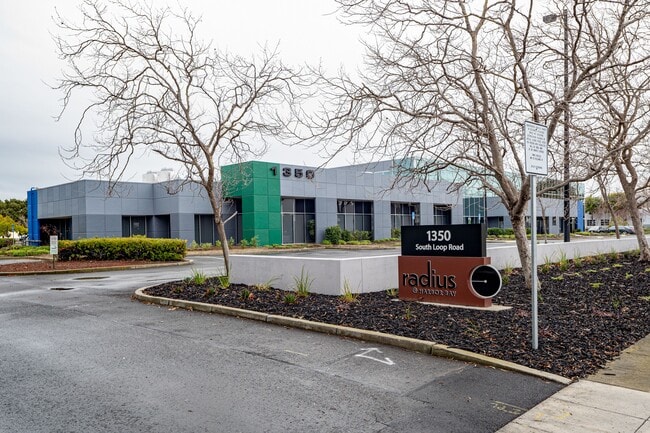
Property Record
1350 S Loop Rd, Alameda, CA 94502


NEARBY LISTINGS FOR SALE OR LEASE
Property Detail
1350 S Loop Rd
Oakland-Fremont-Berkeley, CA
Parcel Map 4890
074-1339-012-00
LOT: 00002 BLK: PM: 0168 PAGE: 0020
Scientificpharmaceuticalmedicalresearchfacility
Alameda
X
California
06001C0251H
2
2024
2.47 AC
2025
Alameda
428301
East Bay/Oakland
39,033 SF
DEMOGRAPHICS near 1350 S Loop Rd
1 Mile
3 Mile
5 Mile
2024 Total Population
4,544
43,657
297,345
2029 Population
4,392
42,344
286,977
Pop Growth 2024-2029
(3.35%)
(3.01%)
(3.49%)
Average Age
43
43
39
2024 Total Households
1,605
15,426
98,391
HH Growth 2024-2029
(3.61%)
(3.20%)
(3.64%)
Median Household Inc
$184,965
$121,319
$77,957
Avg Household Size
2.80
2.70
2.80
2024 Avg HH Vehicles
2.00
2.00
2.00
Median Home Value
$836,120
$1,027,875
$771,754
Median Year Built
1975
1963
1954
Nearby Places
Map Layers
Map Styles
 Street
 Aerial
- Restaurants
- Banks
- Shops
- Fitness
- Groceries
PUBLIC TRANSPORTATION
COMMUTER RAIL
Oakland (Capitol Corridor - Amtrak, Coast Starlight - Amtrak, San Joaquins - Amtrak)
DRIVE
WALK
Distance
Oakland (Capitol Corridor - Amtrak, Coast Starlight - Amtrak, San Joaquins - Amtrak)
15 min
9.9 mi
AIRPORT
Metro Oakland International
DRIVE
WALK
Distance
Metro Oakland International
3 min
1.4 mi
San Francisco International
DRIVE
WALK
Distance
San Francisco International
43 min
32.4 mi
Freight Ports
Port of Oakland
DRIVE
WALK
Distance
Port of Oakland
16 min
10.4 mi
SALE & LEASE HISTORY
LISTING DATE
SALE/LEASE

Sep 24, 2016
For Lease
Jul 06, 2021
For Lease
Nearby Properties
Address
Land Use
TOTAL SIZE
Lot Size
Zoning
Address
Land Use
TOTAL SIZE
Lot Size
Zoning
Address
Land Use
TOTAL SIZE
Lot Size
Zoning
219,200 SF
5.49 AC
Address
Land Use
TOTAL SIZE
Lot Size
Zoning
285,595 SF
53.21 AC
Address
Land Use
TOTAL SIZE
Lot Size
Zoning
165,923 SF
14.99 AC
Address
Land Use
TOTAL SIZE
Lot Size
Zoning
597,179 SF
19.16 AC
Address
Land Use
TOTAL SIZE
Lot Size
Zoning
128,650 SF
6.38 AC
Address
Land Use
TOTAL SIZE
Lot Size
Zoning
180,959 SF
9.38 AC
Address
Land Use
TOTAL SIZE
Lot Size
Zoning
374,725 SF
18.63 AC
Address
Land Use
TOTAL SIZE
Lot Size
Zoning
336,680 SF
9.93 AC
M40
Address
Land Use
TOTAL SIZE
Lot Size
Zoning
323,080 SF
12.50 AC
I2
Address
Land Use
TOTAL SIZE
Lot Size
Zoning
200,238 SF
9.28 AC
Address
Land Use
TOTAL SIZE
Lot Size
Zoning
138,196 SF
8.47 AC
Address
Land Use
TOTAL SIZE
Lot Size
Zoning
155,000 SF
8.41 AC
Address
Land Use
TOTAL SIZE
Lot Size
Zoning
232,068 SF
31.82 AC
Address
Land Use
TOTAL SIZE
Lot Size
Zoning
93,964 SF
24.21 AC
Address
Land Use
TOTAL SIZE
Lot Size
Zoning
76,114 SF
6 AC
Address
Land Use
TOTAL SIZE
Lot Size
Zoning
213,600 SF
10.60 AC
Address
Land Use
TOTAL SIZE
Lot Size
Zoning
100,909 SF
6.70 AC
Address
Land Use
TOTAL SIZE
Lot Size
Zoning
121,597 SF
5.75 AC
Address
Land Use
TOTAL SIZE
Lot Size
Zoning
204,006 SF
6.39 AC
M40
Address
Land Use
TOTAL SIZE
Lot Size
Zoning
80,810 SF
5.62 AC
Address
Land Use
TOTAL SIZE
Lot Size
Zoning
86,973 SF
2.92 AC
Address
Land Use
TOTAL SIZE
Lot Size
Zoning
93,100 SF
24.21 AC
Address
Land Use
TOTAL SIZE
Lot Size
Zoning
6.81 AC
Address
Land Use
TOTAL SIZE
Lot Size
Zoning
311,040 SF
16.05 AC
Address
Land Use
TOTAL SIZE
Lot Size
Zoning
60,846 SF
3.75 AC
Address
Land Use
TOTAL SIZE
Lot Size
Zoning
152,535 SF
1.86 AC
Address
Land Use
TOTAL SIZE
Lot Size
Zoning
95,670 SF
1.95 AC
Address
Land Use
TOTAL SIZE
Lot Size
Zoning
218,947 SF
9.93 AC
Address
Land Use
TOTAL SIZE
Lot Size
Zoning
66,157 SF
7.68 AC
The World's #1 Commercial Real Estate Marketplace
Connect with us
© 2026 CoStar Group
The information above has been obtained from sources believed reliable. While we do not doubt its accuracy we have not verified it and make no guarantee, warranty or representation about it. It is your responsibility to independently confirm its accuracy and completeness. Any projections, opinions, assumptions, or estimates used are for example only and do not represent the current or future performance of the property. The value of this transaction to you depends on tax and other factors which should be evaluated by your tax, financial, and legal advisors. You and your advisors should conduct a careful, independent investigation of the property to determine to your satisfaction the suitability of the property for your needs.